
The United Nations has backed a new approach to world maps that aims to show Africa at a more accurate size compared with other continents.
The resolution, known as “Correct the Map,” was introduced by Togo and supported by members of the African Union. A total of 164 countries voted in favor, including France and the United Kingdom. The United States voted against the resolution, while six countries abstained.
The vote is not legally binding, meaning countries and organizations are not required to immediately change their maps. However, supporters hope it will encourage schools, governments, international organizations and other institutions to use maps that represent the size of continents more accurately.
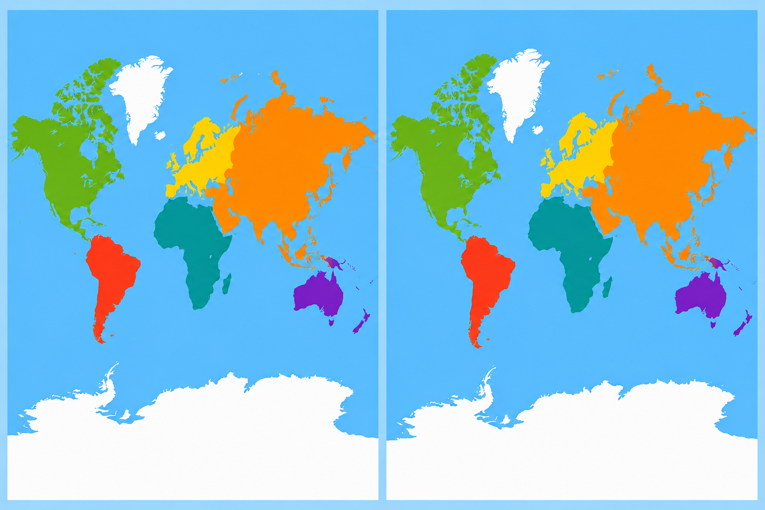
The main target of the campaign is the Mercator projection, a world map created by Flemish cartographer Gerardus Mercator in 1569. The map became widely used because it was useful for navigation. However, it greatly distorts the size of land areas, especially those located farther from the equator.
One of the most noticeable examples is Greenland. On many Mercator maps, Greenland looks almost as large as Africa. In reality, Africa covers about 30.4 million square kilometres, while Greenland covers around 2.2 million square kilometres. Africa is therefore about 14 times larger.
The distortion happens because the Earth is a sphere, while a traditional world map is flat. When the surface of a globe is transferred onto a flat map, some areas must appear stretched or changed.
Supporters of the new map say this distortion can influence how people understand different parts of the world. They argue that making Africa appear much smaller than it really is may contribute to misunderstandings about the continent's size, population, resources and economic potential.
A different map, known as the Equal Earth projection, was developed by cartographers in 2018. Unlike the Mercator projection, Equal Earth is designed to show the relative size of continents more accurately while keeping their overall shapes recognizable.
African Union members adopted the Equal Earth projection earlier this year and said it provides a better representation of Africa's actual size.
Togo's Foreign Minister Robert Dussey supported the campaign, saying that a fair world should also have a fair map. Campaigners behind #CorrectTheMap argue that maps are not simply drawings but can influence how people see countries and continents.
France has also supported the change. French Foreign Minister Jean-Noël Barrot said that changing a map would not change the world, but correcting a distorted representation would provide a more accurate picture.
The United States, however, criticized the UN decision. A US representative argued that the General Assembly should focus more on major international issues such as peace, prosperity and global relations.
Despite the disagreement, supporters believe the UN vote could increase awareness about map distortion and encourage more organizations to use maps that better reflect the real size of Africa and the rest of the world.
Summary
The United Nations General Assembly has voted to support a new world map that shows the true size of Africa more accurately. The resolution, led by Togo and backed by African Union countries, received support from 164 nations. The United States was the only country to vote against it, while six countries abstained.
Content
×
![]()